
College football’s most notable current rivalry has a new variable this weekend, and it is not on either sideline.
No. 2 Georgia and No. 6/7 Alabama, both 5-0 and unbeaten in the SEC, meet Saturday night at Bryant-Denny Stadium with a 6:30 p.m. CT kickoff on ABC. The same window now sits under the projected path of Tropical Depression Nine, which the National Hurricane Center expects to strengthen into Hurricane Isaias and reach the central Gulf Coast late Friday night or Saturday morning.
James Spann, the longtime Alabama meteorologist, said Tuesday evening that the circulation is forecast to move north through eastern Mississippi, putting the state on the eastern side of the storm. For the game itself he wrote that rain is likely, winds could gust to 30–40 mph, and a tornado threat cannot be ruled out during the contest, depending on the exact track and how far inland the remnant low has progressed by evening.
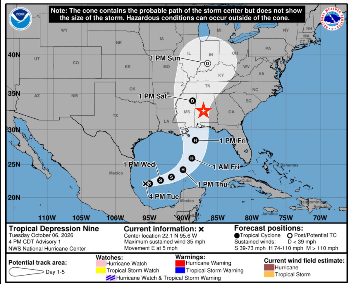
The National Weather Service office in Birmingham is already reflecting that in the Tuscaloosa forecast: a 70 percent chance of showers and possible thunderstorms Saturday afternoon and night, with windy conditions and a high only near 80. Office guidance for central Alabama emphasizes gusty winds and steady rain from Friday into Saturday, and advises residents to begin basic preparations for power outages and localized flooding. Confidence in the finer details—exact landfall point, peak winds inland, and hour-by-hour timing—remains limited until the system organizes further and hurricane-hunter data arrive.
Impacts will not be uniform. Coastal Alabama faces the highest wind, surge, and rainfall totals; Spann notes the potential for more than 5–6 inches near the coast and storm-surge flooding. Farther inland, including the Tuscaloosa area, the more likely problems are periods of heavy rain (generally 1–3 inches, higher in spots over the western half of the state), sustained breezy to windy conditions, and isolated spin-up tornadoes in rain bands. A slower storm could push the worst of the weather later Saturday night or into Sunday morning; most ensemble guidance currently favors the main impact arriving Saturday.
That leaves athletic departments, broadcast crews, and fans in a familiar holding pattern. Spann has already advised organizers of major weekend events—including the Alabama–Georgia game—not to lock in final decisions until forecast confidence rises, which he expects by Wednesday night. Tailgating lots, open concourses, and temporary structures are the obvious soft spots if gusts reach the 30–40 mph range he currently flags for the stadium. A tornado watch overlapping kickoff would force a different set of decisions entirely.
None of this is locked. Tropical forecasts routinely shift 50–100 miles in track or several hours in timing between Tuesday and Friday, and shear near the coast could knock the storm down a category before landfall. What is already clear is that a dry, calm night in Tuscaloosa is no longer the base case. By the time Georgia and Alabama take the field, the third participant in the evening may be the remnants of Isaias.
The SEC has released a statement noting they are monitoring the situation and are in contact with all the programs potentially facing impact from this storm.
As always, stay tuned to The Scoop for the latest news.